 Weston Ski T... Blue Hills S... Nashoba Vall... Bradford Ski...
 Jackson Hole Mountain Resort
  Jackson, Jackson Hole Airport, WY Updated Apr 25 @ 05:16

 West
West WebCams
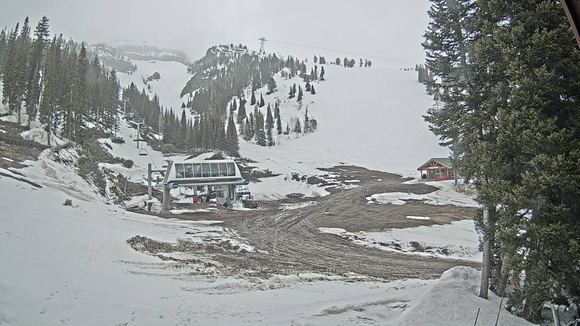
Thunder Chair - 9,300ft

Lower Faces - 6,311ft

Apres Vous

Rendezvous
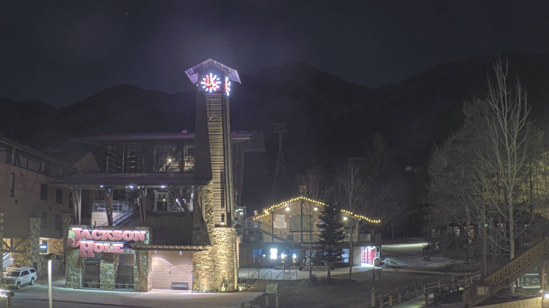
Tram Base
THURSDAY
Apr 25

47° / 35°

4 - 11
mph
 0
0
FRIDAY
Apr 26
46° / 34°
6 - 14
mph
0
SATURDAY
Apr 27
42° / 30°
6 - 14
mph
1
SUNDAY
Apr 28
38° / 32°
5 - 13
mph
0
MONDAY
Apr 29

43° / 30°

17 - 28
mph
0
TUESDAY
Apr 30

53° / 39°

9 - 17
mph
0
WEDNESDAY
May 1

59° / 44°
8 - 16
mph
0
Mostly cloudy becoming partly cloudy at times and then mostly cloudy overnight. Periods of rain are expected at any time.
No snow.
Potential Precip:
0.08 to 0.38
Hi: 51°Low: 37°
8,578 feet to 10312 feet
Winds variable at 4 to 12 mph in the morning, becoming calm in the afternoon, and then variable at 5 to 12 mph overnight.
Mostly cloudy becoming partly cloudy at times and then mostly cloudy overnight. Periods of snow are expected at any time.
Moderate snow during the day, becoming light in the evening through overnight. Snowfall is forecast to be 2 to 4 during the day, and a trace amount in the evening and overnight.
Potential Precip:
0.08 to 0.38
Hi: 28°Low: 22°
8,578 feet to 10312 feet
Winds W at 13 to 24 mph in the morning, becoming W at 18 to 29 mph in the afternoon, and then W at 10 to 19 mph overnight.
Partly cloudy becoming mostly cloudy in the late morning continuing through overnight, with periods of rain expected at any time.
No snow.
Potential Precip:
0.02 to 0.09
Hi: 50°Low: 37°
8,377 feet to 9932 feet
Winds variable at 5 to 13 mph through the day, becoming variable at 4 to 12 mph overnight.
Partly cloudy becoming mostly cloudy in the late morning continuing through overnight, with periods of snow expected at any time.
Light snow through the day and into overnight. Snowfall is forecast to be a trace amount during the day, and a trace amount in the evening and overnight.
Potential Precip:
0.02 to 0.09
Hi: 26°Low: 24°
8,377 feet to 9932 feet
Winds variable at 8 to 16 mph in the morning, becoming NE at 17 to 28 mph in the afternoon, and then variable at 10 to 19 mph with gusts to 27 overnight.
Mostly cloudy through the day and overnight, with periods of rain and snow expected overnight.
Light snow overnight. Snowfall is forecast to be a trace amount overnight.
Potential Precip:
0.12 to 0.62
Hi: 46°Low: 34°
6,825 feet to 9651 feet
Winds variable at 5 to 13 mph in the morning, becoming variable at 4 to 12 mph in the afternoon, and then variable at 3 to 11 mph overnight.
Mostly cloudy through the day and overnight, with periods of snow expected at any time.
Heavy snow during the day, becoming light in the evening through overnight with periods of moderate. Snowfall is forecast to be 3 to 5 during the day, and 2 to 3 inches in the evening and overnight.
Potential Precip:
0.12 to 0.62
Hi: 27°Low: 17°
6,825 feet to 9651 feet
Winds NW at 6 to 14 mph in the morning, becoming W at 10 to 19 mph in the afternoon, and then W at 12 to 21 mph overnight.
Partly cloudy becoming mostly cloudy in the late morning continuing through overnight, with periods of rain and snow expected overnight.
Periods of light snow throughout the day. Snowfall is forecast to be a trace amount.
Potential Precip:
0.08 to 0.42
Hi: 42°Low: 32°
6,840 feet to 8624 feet
Winds W at 6 to 14 mph in the morning, becoming variable at 5 to 12 mph in the afternoon, and then SW at 6 to 14 mph overnight.
Partly cloudy becoming mostly cloudy in the late morning continuing through overnight, with periods of snow expected at any time.
Periods of moderate snow throughout the day, heavy at times overnight. Snowfall is forecast to be 4 to 6 inches.
Potential Precip:
0.08 to 0.42
Hi: 21°Low: 19°
6,840 feet to 8624 feet
Winds W at 17 to 28 mph in the morning, becoming SW at 17 to 28 mph in the afternoon, and then W at 33 to 44 mph overnight.
Partly cloudy becoming cloudy at times and then mostly cloudy overnight. Periods of rain and snow are expected overnight.
Periods of light snow throughout the day. Snowfall is forecast to be a trace amount.
Potential Precip:
0.04 to 0.22
Hi: 47°Low: 31°
6,035 feet to 9319 feet
Winds W at 13 to 22 mph with gusts to 33 through the day, becoming variable at 4 to 12 mph overnight.
Partly cloudy becoming cloudy at times and then mostly cloudy overnight. Periods of snow are expected in the morning through afternoon.
Periods of moderate to heavy snow throughout the day. Snowfall is forecast to be 2 to 4 inches.
Potential Precip:
0.04 to 0.22
Hi: 22°Low: 18°
6,035 feet to 9319 feet
Winds W at 36 to 47 mph with gusts to 53 through the day, becoming SW at 21 to 32 mph with gusts to 38 overnight.
Mostly cloudy becoming mostly clear in the late morning continuing through overnight, with windy conditions at times.
No snow.
No precipitation expected.
Hi: 58°Low: 38°
9,795 feet to 11396 feet
Winds variable at 7 to 15 mph through the day, becoming variable at 4 to 12 mph overnight.
Mostly cloudy becoming mostly clear in the late morning continuing through overnight, with windy conditions at times.
No snow.
No precipitation expected.
Hi: 33°Low: 26°
9,795 feet to 11396 feet
Winds SW at 18 to 29 mph through the day, becoming SW at 15 to 26 mph overnight.
Partly cloudy becoming mostly clear at times continuing through overnight, with periods of rain expected in the morning.
No snow.
Potential Precip:
0.03 to 0.14
Hi: 64°Low: 43°
11,898 feet to 12544 feet
Winds variable at 6 to 14 mph through the day, becoming variable at 5 to 13 mph overnight.
Partly cloudy becoming mostly clear at times continuing through overnight, with periods of snow expected in the morning.
Periods of light snow throughout the day. Snowfall is forecast to be a trace amount.
Potential Precip:
0.03 to 0.14
Hi: 38°Low: 35°
11,898 feet to 12544 feet
Winds SW at 15 to 26 mph through the day, becoming S at 23 to 34 mph overnight.
 Sunrise & Sunset

Lunar Calendar


 Snow Maps and Weather Stations in the Area
 ![]() 18in, past 4 days. Snow surface is powder and machine groomed
18in, past 4 days. Snow surface is powder and machine groomed
Snow report provided by SnoCountry
 Mountain Base


