 Mad River Mo... Nitehawk Ski... Clear Fork R... Snow Trails
 Summit @ Snoqualmie-East
  Stampede Pass, WA Updated May 14 @ 09:13

 Southwest
 WebCams

Top of Alpental

Alpental Base

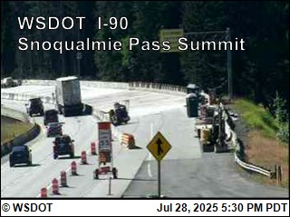
Summit Central
Summit Road Cam
TUESDAY
May 14

56° / 44°

5 - 12
mph
 0
0
WEDNESDAY
May 15

58° / 44°
5 - 12
mph
0
THURSDAY
May 16

46° / 32°
6 - 14
mph
3
FRIDAY
May 17
42° / 35°
6 - 14
mph
0
SATURDAY
May 18
40° / 32°
4 - 12
mph
2
SUNDAY
May 19
40° / 36°
4 - 12
mph
0
MONDAY
May 20
42° / 37°
4 - 12
mph
0
advertisement

Partly cloudy becoming mostly clear in the late morning and then mostly cloudy overnight. Expect windy conditions at times.
No snow.
No precipitation expected.
Hi: 56°Low: 44°
10,635 feet to 12481 feet
Winds NW at 7 to 15 mph in the morning, becoming variable at 5 to 12 mph in the afternoon through overnight.
Mostly cloudy becoming mostly clear in the afternoon and then partly cloudy overnight. Periods of rain are expected overnight.
No snow.
Potential Precip:
0 to 0.02
Hi: 58°Low: 44°
8,935 feet to 12064 feet
Winds NW at 7 to 15 mph in the morning, becoming variable at 5 to 12 mph in the afternoon, and then variable at 4 to 11 mph overnight.
Mostly cloudy becoming cloudy in the evening continuing through overnight, with periods of rain and snow expected overnight.
Light snow through the day into the evening with periods of moderate in the evening, becoming moderate overnight. Snowfall is forecast to be a trace amount during the day, and 3 to 5 inches in the evening and overnight.
Potential Precip:
0.28 to 1.38
Hi: 46°Low: 32°
3,389 feet to 8246 feet
Winds variable at 4 to 12 mph in the morning, becoming W at 6 to 14 mph in the afternoon, and then variable at 5 to 13 mph overnight.
Mostly cloudy through the day becoming cloudy overnight. Periods of rain and snow are expected overnight.
Periods of light snow throughout the day and overnight. Snowfall is forecast to be a trace amount.
Potential Precip:
0.05 to 0.25
Hi: 42°Low: 35°
4,409 feet to 5424 feet
Winds NW at 7 to 15 mph in the morning, becoming NW at 6 to 14 mph in the afternoon, and then variable at 5 to 12 mph overnight.
Mostly cloudy becoming cloudy in the late morning continuing through overnight. Periods of rain and snow are expected overnight.
Periods of light to moderate snow throughout the day, light at times overnight. Snowfall is forecast to be 2 to 4 inches.
Potential Precip:
0.18 to 0.9
Hi: 40°Low: 32°
3,461 feet to 5126 feet
Winds variable at 4 to 12 mph throughout the day and into overnight.
Mostly cloudy becoming partly cloudy in the afternoon continuing through overnight. Periods of rain and snow are expected overnight.
Periods of light snow throughout the day. Snowfall is forecast to be a trace amount.
Potential Precip:
0.03 to 0.17
Hi: 40°Low: 36°
4,619 feet to 5219 feet
Winds variable at 4 to 12 mph throughout the day and into overnight.
Mostly cloudy becoming cloudy at times continuing through overnight, with periods of rain and snow expected overnight.
Periods of light snow throughout the day and overnight. Snowfall is forecast to be a trace amount.
Potential Precip:
0.04 to 0.18
Hi: 42°Low: 37°
4,704 feet to 5389 feet
Winds variable at 4 to 12 mph through the day, becoming variable at 4 to 11 mph overnight.
 Sunrise & Sunset

Lunar Calendar


advertisement
 Snow Maps and Weather Stations in the Area
  Mid-Mountain


