 Stevens Pass... Summit @ Sno... Summit @ Sno... Summit @ Sno...
 Bogus Basin
  BOGUS BASIN Updated Oct 02 @ 11:00


 WebCams

Coaster
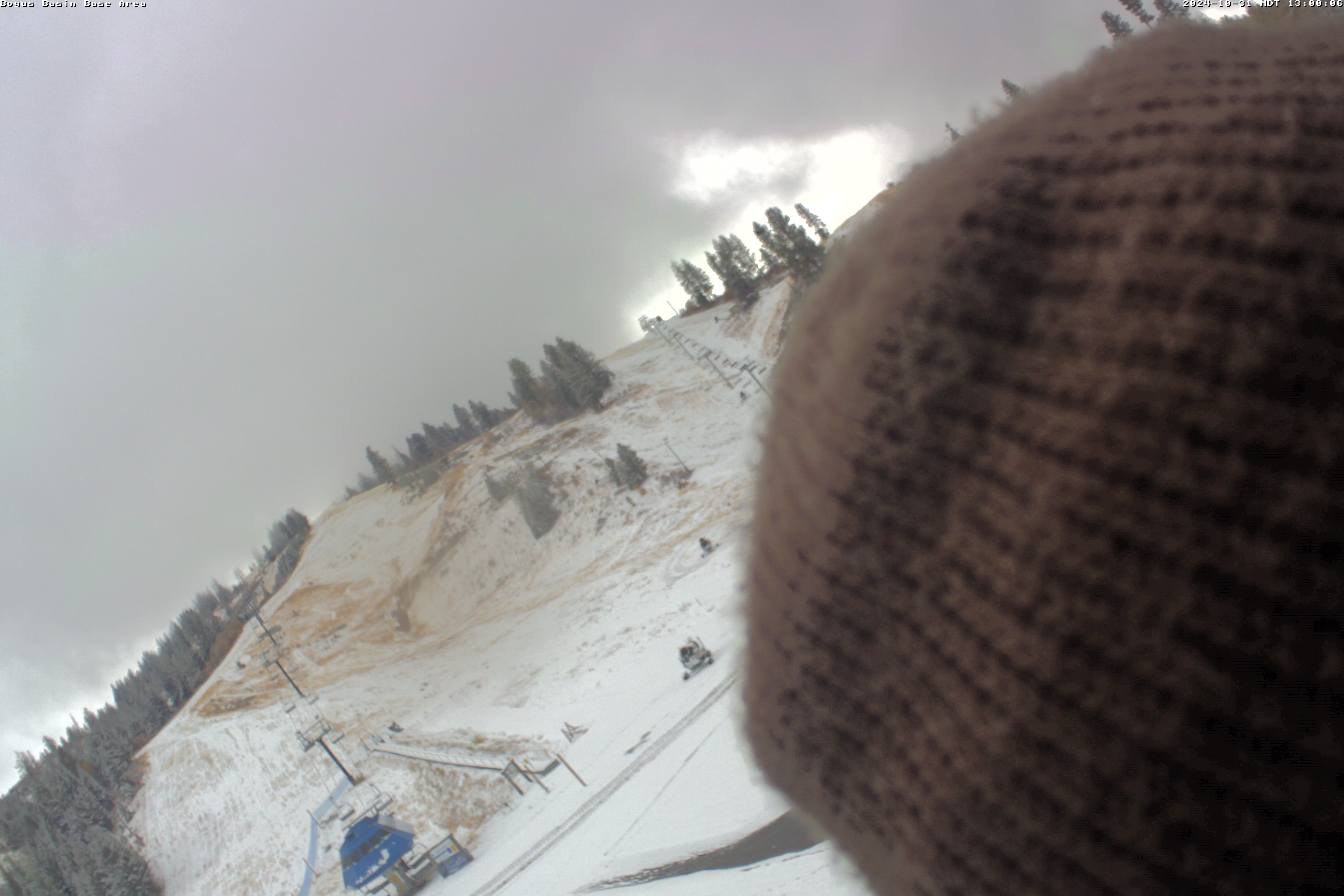
Base Area
Snow Stake
FRIDAY
May 3

48° / 27°

15 - 26
mph
 0
0
SATURDAY
May 4

56° / 28°

25 - 36
mph
7
SUNDAY
May 5

33° / 26°

8 - 16
mph
4
MONDAY
May 6
34° / 23°
8 - 16
mph
2
TUESDAY
May 7
30° / 20°

21 - 32
mph
1
WEDNESDAY
May 8

39° / 34°
13 - 22
mph
0
THURSDAY
May 9
47° / 43°
4 - 12
mph
0
Partly cloudy to mostly clear and milder, becoming mostly cloudy as clouds increase in the evening, overnight (storm incoming).
None
None
Hi: 48°Low: 27°
7,793 feet to 10770 feet
Winds S at 8 to 16 mph in the morning, becoming SE at 11 to 20 mph in the afternoon, and then E at 10 to 18 mph with gusts to 26 overnight.
Mostly clear becoming mostly cloudy at times continuing through overnight, with windy conditions at times.
No snow.
No precipitation expected.
Hi: 42°Low: 33°
7,793 feet to 10770 feet
Winds S at 9 to 17 mph in the morning, becoming SE at 16 to 27 mph in the afternoon, and then SE at 19 to 30 mph overnight.
Mostly cloudy and milder through the day, with gusty winds (storm moving in), and showers starting later afternoon, cloudy with heavier showers in the evening, overnight, with some heavy snow expected. Snow levels go from 7,000 feet, to near 5,500 feet overnight.
Periods of snow by afternoon, heavy in thre evening, overnight. Snowfall is forecast to be 5 to 8 inches (possibly to 10 inches of snow up top).
Potential Precip:
0.6 to 1.25, 100% chance
Hi: 56°Low: 28°
4,946 feet to 10870 feet
Winds SE at 21 to 32 mph with gusts to 45 in the morning, becoming SE at 15 to 26 mph with gusts to 36 in the afternoon, and then S at 10 to 18 mph overnight.
Cloudy through the day and overnight, with periods of rain and snow expected overnight.
Heavy snow in the evening and moderate with periods of heavy overnight. Snowfall is forecast to be 6 to 9 inches in the evening and overnight.
Potential Precip:
0.29 to 1.46
Hi: 48°Low: 22°
4,946 feet to 10870 feet
Winds SE at 32 to 43 mph with gusts to 51 in the morning, becoming SE at 34 to 45 mph in the afternoon, and then S at 13 to 22 mph overnight.
Cloudy becoming mostly cloudy at times continuing through overnight, colder. Periods of snow are expected at any time, most steady and heavy in the morning.
Periods of snow, lighter overnight. Snowfall is forecast to be 3 to 5 inches.
Potential Precip:
0.28 to 0.55, 80% chance
Hi: 33°Low: 26°
5,287 feet to 5899 feet
Winds variable at 4 to 12 mph through the day, becoming W at 8 to 16 mph with gusts to 23 overnight.
Cloudy becoming mostly cloudy at times continuing through overnight, with periods of snow expected at any time.
Moderate snow through the day into the evening with periods of heavy in the evening, becoming heavy overnight. Snowfall is forecast to be 1 to 2 during the day, and 5 to 8 inches in the evening and overnight.
Potential Precip:
0.2 to 1
Hi: 27°Low: 23°
5,287 feet to 5899 feet
Winds SW at 6 to 14 mph in the morning, becoming W at 16 to 27 mph in the afternoon, and then W at 17 to 28 mph with gusts to 36 overnight.
Mostly cloudy through the day and overnight, cold, with periods of snow expected at any time.
Periods of snow. Snowfall is forecast to be 2 to 3 inches.
Potential Precip:
0.13 to 0.34, 60% chance
Hi: 34°Low: 23°
3,377 feet to 6241 feet
Winds SW at 10 to 19 mph with gusts to 27 in the morning, becoming variable at 4 to 12 mph in the afternoon, and then W at 13 to 22 mph with gusts to 36 overnight.
Mostly cloudy through the day and overnight, with periods of snow expected at any time.
Periods of moderate to heavy snow throughout the day and overnight. Snowfall is forecast to be 6 to 9 inches.
Potential Precip:
0.17 to 0.87
Hi: 28°Low: 18°
3,377 feet to 6241 feet
Winds W at 22 to 33 mph in the morning, becoming NW at 14 to 23 mph in the afternoon, and then NW at 23 to 34 mph overnight.
Mostly cloudy and cold, with periods of snow expected in the morning through overnight, mostly light.
Periods of snow. Snowfall is forecast to be 1 to 2 inches.
Potential Precip:
0.08 to 0.25, 50% chance
Hi: 30°Low: 20°
2,930 feet to 6333 feet
Winds NW at 16 to 27 mph through the day, becoming SW at 7 to 15 mph overnight.
Mostly cloudy becoming mostly clear in the late morning and then partly cloudy overnight. Periods of snow are expected in the morning.
Periods of snow throughout the day and overnight.
Potential Precip:
0.04 to 0.19
Hi: 25°Low: 22°
2,930 feet to 6333 feet
Winds NW at 20 to 31 mph through the day, becoming N at 11 to 20 mph overnight.
Mostly cloudy becoming clear at times and then mostly clear overnight. Periods of rain are expected in the morning.
No snow.
Potential Precip:
0 to 0.01
Hi: 44°Low: 38°
7,066 feet to 8502 feet
Winds variable at 11 to 20 mph through the day, becoming variable at 4 to 12 mph overnight.
Mostly cloudy becoming clear at times and then mostly clear overnight. Periods of snow are expected in the morning.
Periods of snow throughout the day and overnight.
Potential Precip:
0 to 0.01
Hi: 35°Low: 29°
7,066 feet to 8502 feet
Winds variable at 13 to 24 mph through the day, becoming variable at 4 to 12 mph overnight.
Mostly cloudy becoming mostly clear in the afternoon continuing through overnight, with windy conditions at times.
No snow.
No precipitation expected.
Hi: 52°Low: 45°
8,858 feet to 9744 feet
Winds variable at 3 to 11 mph through the day, becoming variable at 4 to 12 mph overnight.
Mostly cloudy becoming mostly clear in the afternoon continuing through overnight, with windy conditions at times.
No snow.
No precipitation expected.
Hi: 42°Low: 38°
8,858 feet to 9744 feet
Winds variable at 5 to 13 mph through the day, becoming E at 7 to 15 mph overnight.
 Sunrise & Sunset

Lunar Calendar


 Bogus Basin Discussion
  Snow Maps and Weather Stations in the Area
 ![]() 12 - 15in, past 6 days. Snow surface is packed powder and machine groomed
12 - 15in, past 6 days. Snow surface is packed powder and machine groomed
Snow report provided by SnoCountry
Plan your future trip using our temperature, snowfall, snow depth, and precipitation tool
 Day |
 High Temperatures |
 Low Temperatures |
 Precipitation |
 Snowfall |
 Snow Depth |
||||||||||||||
|---|---|---|---|---|---|---|---|---|---|---|---|---|---|---|---|---|---|---|---|
| Avg | High | Year | Low | Year | Avg | High | Year | Low | Year | Avg | Max | Year | Avg | Max | Year | Avg | Max | Year | |
| 1 | 48 | 57 | 1968 | 35 | 1967 | 30 | 43 | 1957 | 14 | 1967 | 0.113 | 1.35 | 1964 | 0.17 | 2.0 | 1959 | 24.7 | 72 | 1970 |
| 2 | 44 | 70 | 1966 | 28 | 1959 | 30 | 40 | 1966 | 16 | 1964 | 0.044 | 0.37 | 1955 | 1.37 | 14.0 | 1964 | 24.9 | 72 | 1955 |
| 3 | 47 | 75 | 1966 | 26 | 1964 | 33 | 47 | 1966 | 16 | 1964 | 0.010 | 0.05 | 1960 | 0.37 | 5.0 | 1957 | 23.7 | 71 | 1955 |
| 4 | 49 | 74 | 1966 | 32 | 1960 | 32 | 50 | 1966 | 20 | 1964 | 0.094 | 0.52 | 1961 | 0.73 | 6.0 | 1961 | 22.9 | 66 | 1955 |
| 5 | 49 | 71 | 1966 | 26 | 1961 | 33 | 50 | 1958 | 18 | 1964 | 0.043 | 0.20 | 1964 | 0.23 | 2.0 | 1961 | 23.7 | 62 | 1955 |
| 6 | 50 | 69 | 1966 | 30 | 1968 | 35 | 52 | 1966 | 15 | 1968 | 0.009 | 0.07 | 1961 | 0.07 | 1.0 | 1961 | 20.4 | 59 | 1955 |
| 7 | 52 | 66 | 1966 | 40 | 1964 | 36 | 49 | 1969 | 24 | 1970 | 0.093 | 0.53 | 1960 | T | T | 1970 | 18.2 | 55 | 1955 |
| 8 | 54 | 80 | 1969 | 39 | 1963 | 38 | 56 | 1966 | 29 | 1960 | 0.034 | 0.29 | 1960 | 0.03 | 0.5 | 1960 | 16.9 | 53 | 1955 |
| 9 | 53 | 65 | 1969 | 35 | 1963 | 37 | 50 | 1969 | 26 | 1963 | 0.033 | 0.30 | 1963 | 0.27 | 4.0 | 1963 | 14.7 | 51 | 1955 |
| 10 | 51 | 67 | 1960 | 35 | 1970 | 35 | 54 | 1960 | 22 | 1970 | 0.017 | 0.17 | 1961 | 0.10 | 1.5 | 1961 | 13.6 | 48 | 1970 |
| 11 | 49 | 71 | 1969 | 33 | 1970 | 33 | 59 | 1960 | 14 | 1970 | 0.088 | 0.42 | 1957 | 0.57 | 5.0 | 1956 | 12.3 | 45 | 1955 |
| 12 | 47 | 67 | 1960 | 31 | 1970 | 33 | 50 | 1969 | 18 | 1970 | 0.159 | 0.89 | 1957 | 0.73 | 6.0 | 1958 | 12.6 | 46 | 1970 |
| 13 | 49 | 72 | 1959 | 35 | 1970 | 31 | 53 | 1959 | 22 | 1970 | 0.028 | 0.31 | 1957 | 0.03 | 0.5 | 1970 | 9.2 | 40 | 1955 |
| 14 | 48 | 69 | 1959 | 32 | 1968 | 31 | 48 | 1959 | 20 | 1966 | 0.141 | 0.83 | 1957 | 0.57 | 4.0 | 1955 | 8.6 | 44 | 1955 |
| 15 | 51 | 61 | 1970 | 29 | 1955 | 33 | 41 | 1956 | 18 | 1955 | 0.097 | 1.20 | 1959 | 1.03 | 10.0 | 1959 | 12.6 | 48 | 1970 |
| 16 | 52 | 69 | 1964 | 32 | 1955 | 36 | 50 | 1970 | 26 | 1959 | 0.075 | 0.31 | 1955 | 0.47 | 4.5 | 1955 | 11.1 | 48 | 1955 |
| 17 | 56 | 69 | 1956 | 35 | 1960 | 39 | 54 | 1956 | 23 | 1960 | 0.021 | 0.15 | 1959 | 0.07 | 0.5 | 1960 | 8.9 | 46 | 1955 |
| 18 | 56 | 69 | 1956 | 31 | 1960 | 40 | 58 | 1956 | 21 | 1960 | 0.149 | 1.12 | 1957 | 0.50 | 7.5 | 1960 | 7.7 | 39 | 1955 |
| 19 | 55 | 69 | 1964 | 38 | 1959 | 40 | 56 | 1958 | 23 | 1959 | 0.073 | 0.64 | 1957 | 0.07 | 1.0 | 1957 | 6.3 | 36 | 1955 |
| 20 | 55 | 72 | 1958 | 31 | 1962 | 41 | 58 | 1958 | 25 | 1962 | 0.040 | 0.38 | 1962 | 0.17 | 2.0 | 1962 | 6.0 | 34 | 1955 |
| 21 | 56 | 72 | 1958 | 39 | 1968 | 40 | 59 | 1958 | 21 | 1960 | 0.061 | 0.36 | 1960 | T | T | 1962 | 4.8 | 28 | 1970 |
| 22 | 55 | 71 | 1956 | 35 | 1960 | 39 | 58 | 1967 | 20 | 1960 | 0.009 | 0.05 | 1966 | 0.00 | 0.0 | 1970 | 4.5 | 24 | 1970 |
| 23 | 56 | 71 | 1969 | 38 | 1960 | 38 | 55 | 1967 | 25 | 1966 | 0.047 | 0.39 | 1962 | 0.02 | 0.3 | 1970 | 3.5 | 24 | 1955 |
| 24 | 55 | 71 | 1969 | 34 | 1962 | 39 | 56 | 1969 | 25 | 1960 | 0.092 | 0.68 | 1956 | 0.23 | 2.0 | 1962 | 3.0 | 23 | 1955 |
| 25 | 57 | 72 | 1966 | 39 | 1962 | 40 | 54 | 1958 | 25 | 1960 | 0.007 | 0.05 | 1962 | 0.13 | 1.0 | 1962 | 2.2 | 19 | 1955 |
| 26 | 57 | 77 | 1966 | 37 | 1968 | 41 | 58 | 1966 | 24 | 1968 | 0.038 | 0.31 | 1955 | 0.13 | 2.0 | 1955 | 1.5 | 21 | 1955 |
| 27 | 57 | 72 | 1966 | 40 | 1959 | 39 | 59 | 1966 | 23 | 1955 | 0.139 | 0.90 | 1964 | T | T | 1962 | 1.4 | 19 | 1955 |
| 28 | 58 | 72 | 1966 | 39 | 1959 | 41 | 55 | 1966 | 27 | 1959 | 0.061 | 0.43 | 1959 | 0.27 | 4.0 | 1959 | 1.1 | 16 | 1955 |
| 29 | 59 | 66 | 1966 | 49 | 1959 | 43 | 54 | 1966 | 32 | 1959 | 0.023 | 0.23 | 1964 | T | T | 1962 | 0.7 | 10 | 1955 |
| 30 | 57 | 65 | 1956 | 49 | 1970 | 40 | 50 | 1960 | 28 | 1970 | 0.014 | 0.09 | 1961 | 0.00 | 0.0 | 1970 | 0.4 | 6 | 1955 |
| 31 | 58 | 70 | 1956 | 43 | 1955 | 40 | 56 | 1956 | 24 | 1955 | 0.041 | 0.61 | 1958 | T | T | 1966 | 0.2 | 3 | 1955 |
Day |
High Temperatures |
Low Temperatures |
Precipitation |
Snowfall |
Snow Depth |
||||||||||||||
|---|---|---|---|---|---|---|---|---|---|---|---|---|---|---|---|---|---|---|---|
| Avg | High | Year | Low | Year | Avg | High | Year | Low | Year | Avg | Max | Year | Avg | Max | Year | Avg | Max | Year | |
| 1 | 48 | 57 | 1968 | 35 | 1967 | 30 | 43 | 1957 | 14 | 1967 | 0.113 | 1.35 | 1964 | 0.17 | 2.0 | 1959 | 24.7 | 72 | 1970 |
| 2 | 44 | 70 | 1966 | 28 | 1959 | 30 | 40 | 1966 | 16 | 1964 | 0.044 | 0.37 | 1955 | 1.37 | 14.0 | 1964 | 24.9 | 72 | 1955 |
| 3 | 47 | 75 | 1966 | 26 | 1964 | 33 | 47 | 1966 | 16 | 1964 | 0.010 | 0.05 | 1960 | 0.37 | 5.0 | 1957 | 23.7 | 71 | 1955 |
| 4 | 49 | 74 | 1966 | 32 | 1960 | 32 | 50 | 1966 | 20 | 1964 | 0.094 | 0.52 | 1961 | 0.73 | 6.0 | 1961 | 22.9 | 66 | 1955 |
| 5 | 49 | 71 | 1966 | 26 | 1961 | 33 | 50 | 1958 | 18 | 1964 | 0.043 | 0.20 | 1964 | 0.23 | 2.0 | 1961 | 23.7 | 62 | 1955 |
| 6 | 50 | 69 | 1966 | 30 | 1968 | 35 | 52 | 1966 | 15 | 1968 | 0.009 | 0.07 | 1961 | 0.07 | 1.0 | 1961 | 20.4 | 59 | 1955 |
| 7 | 52 | 66 | 1966 | 40 | 1964 | 36 | 49 | 1969 | 24 | 1970 | 0.093 | 0.53 | 1960 | T | T | 1970 | 18.2 | 55 | 1955 |
| 8 | 54 | 80 | 1969 | 39 | 1963 | 38 | 56 | 1966 | 29 | 1960 | 0.034 | 0.29 | 1960 | 0.03 | 0.5 | 1960 | 16.9 | 53 | 1955 |
| 9 | 53 | 65 | 1969 | 35 | 1963 | 37 | 50 | 1969 | 26 | 1963 | 0.033 | 0.30 | 1963 | 0.27 | 4.0 | 1963 | 14.7 | 51 | 1955 |
| 10 | 51 | 67 | 1960 | 35 | 1970 | 35 | 54 | 1960 | 22 | 1970 | 0.017 | 0.17 | 1961 | 0.10 | 1.5 | 1961 | 13.6 | 48 | 1970 |
| 11 | 49 | 71 | 1969 | 33 | 1970 | 33 | 59 | 1960 | 14 | 1970 | 0.088 | 0.42 | 1957 | 0.57 | 5.0 | 1956 | 12.3 | 45 | 1955 |
| 12 | 47 | 67 | 1960 | 31 | 1970 | 33 | 50 | 1969 | 18 | 1970 | 0.159 | 0.89 | 1957 | 0.73 | 6.0 | 1958 | 12.6 | 46 | 1970 |
| 13 | 49 | 72 | 1959 | 35 | 1970 | 31 | 53 | 1959 | 22 | 1970 | 0.028 | 0.31 | 1957 | 0.03 | 0.5 | 1970 | 9.2 | 40 | 1955 |
| 14 | 48 | 69 | 1959 | 32 | 1968 | 31 | 48 | 1959 | 20 | 1966 | 0.141 | 0.83 | 1957 | 0.57 | 4.0 | 1955 | 8.6 | 44 | 1955 |
| 15 | 51 | 61 | 1970 | 29 | 1955 | 33 | 41 | 1956 | 18 | 1955 | 0.097 | 1.20 | 1959 | 1.03 | 10.0 | 1959 | 12.6 | 48 | 1970 |
| 16 | 52 | 69 | 1964 | 32 | 1955 | 36 | 50 | 1970 | 26 | 1959 | 0.075 | 0.31 | 1955 | 0.47 | 4.5 | 1955 | 11.1 | 48 | 1955 |
| 17 | 56 | 69 | 1956 | 35 | 1960 | 39 | 54 | 1956 | 23 | 1960 | 0.021 | 0.15 | 1959 | 0.07 | 0.5 | 1960 | 8.9 | 46 | 1955 |
| 18 | 56 | 69 | 1956 | 31 | 1960 | 40 | 58 | 1956 | 21 | 1960 | 0.149 | 1.12 | 1957 | 0.50 | 7.5 | 1960 | 7.7 | 39 | 1955 |
| 19 | 55 | 69 | 1964 | 38 | 1959 | 40 | 56 | 1958 | 23 | 1959 | 0.073 | 0.64 | 1957 | 0.07 | 1.0 | 1957 | 6.3 | 36 | 1955 |
| 20 | 55 | 72 | 1958 | 31 | 1962 | 41 | 58 | 1958 | 25 | 1962 | 0.040 | 0.38 | 1962 | 0.17 | 2.0 | 1962 | 6.0 | 34 | 1955 |
| 21 | 56 | 72 | 1958 | 39 | 1968 | 40 | 59 | 1958 | 21 | 1960 | 0.061 | 0.36 | 1960 | T | T | 1962 | 4.8 | 28 | 1970 |
| 22 | 55 | 71 | 1956 | 35 | 1960 | 39 | 58 | 1967 | 20 | 1960 | 0.009 | 0.05 | 1966 | 0.00 | 0.0 | 1970 | 4.5 | 24 | 1970 |
| 23 | 56 | 71 | 1969 | 38 | 1960 | 38 | 55 | 1967 | 25 | 1966 | 0.047 | 0.39 | 1962 | 0.02 | 0.3 | 1970 | 3.5 | 24 | 1955 |
| 24 | 55 | 71 | 1969 | 34 | 1962 | 39 | 56 | 1969 | 25 | 1960 | 0.092 | 0.68 | 1956 | 0.23 | 2.0 | 1962 | 3.0 | 23 | 1955 |
| 25 | 57 | 72 | 1966 | 39 | 1962 | 40 | 54 | 1958 | 25 | 1960 | 0.007 | 0.05 | 1962 | 0.13 | 1.0 | 1962 | 2.2 | 19 | 1955 |
| 26 | 57 | 77 | 1966 | 37 | 1968 | 41 | 58 | 1966 | 24 | 1968 | 0.038 | 0.31 | 1955 | 0.13 | 2.0 | 1955 | 1.5 | 21 | 1955 |
| 27 | 57 | 72 | 1966 | 40 | 1959 | 39 | 59 | 1966 | 23 | 1955 | 0.139 | 0.90 | 1964 | T | T | 1962 | 1.4 | 19 | 1955 |
| 28 | 58 | 72 | 1966 | 39 | 1959 | 41 | 55 | 1966 | 27 | 1959 | 0.061 | 0.43 | 1959 | 0.27 | 4.0 | 1959 | 1.1 | 16 | 1955 |
| 29 | 59 | 66 | 1966 | 49 | 1959 | 43 | 54 | 1966 | 32 | 1959 | 0.023 | 0.23 | 1964 | T | T | 1962 | 0.7 | 10 | 1955 |
| 30 | 57 | 65 | 1956 | 49 | 1970 | 40 | 50 | 1960 | 28 | 1970 | 0.014 | 0.09 | 1961 | 0.00 | 0.0 | 1970 | 0.4 | 6 | 1955 |
| 31 | 58 | 70 | 1956 | 43 | 1955 | 40 | 56 | 1956 | 24 | 1955 | 0.041 | 0.61 | 1958 | T | T | 1966 | 0.2 | 3 | 1955 |
 Mountain Base


