 Stevens Pass...
  Summit @ Sno... Summit @ Sno... Summit @ Sno...
 Mont Ripley
  Houghton County Memorial Airport, MI Updated May 16 @ 09:10

 East
East WebCams
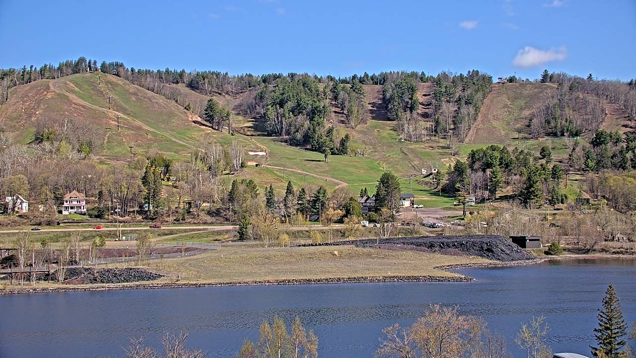
Ripley Cam—Still Image
Ripley Cam—Motion
THURSDAY
May 16

58° / 47°

10 - 19
mph
 0
0
FRIDAY
May 17
66° / 47°

8 - 16
mph
0
SATURDAY
May 18
83° / 53°
11 - 20
mph
0
SUNDAY
May 19

72° / 59°
6 - 14
mph
0
MONDAY
May 20

76° / 54°
8 - 16
mph
0
TUESDAY
May 21
58° / 48°
7 - 15
mph
0
WEDNESDAY
May 22
60° / 45°

15 - 26
mph
0
advertisement

Cloudy becoming partly cloudy at times and then mostly clear overnight. Periods of rain are expected in the morning through afternoon.
No snow.
Potential Precip:
0.04 to 0.18
Hi: 58°Low: 47°
8,288 feet to 9672 feet
Winds E at 6 to 14 mph with gusts to 20 in the morning, becoming S at 10 to 19 mph with gusts to 26 in the afternoon, and then SW at 8 to 16 mph with gusts to 26 overnight.
Mostly clear becoming partly cloudy at times continuing through overnight, with periods of rain expected overnight.
No snow.
Potential Precip:
0 to 0.01
Hi: 66°Low: 47°
9,076 feet to 11251 feet
Winds W at 9 to 17 mph in the morning, becoming E at 8 to 16 mph in the afternoon, and then variable at 4 to 12 mph with gusts to 30 overnight.
Clear through the day and overnight.
No snow.
Potential Precip:
0.03 to 0.16
Hi: 83°Low: 53°
10,094 feet to 12199 feet
Winds S at 14 to 23 mph in the morning, becoming variable at 11 to 20 mph with gusts to 30 in the afternoon, and then W at 10 to 18 mph with gusts to 34 overnight.
Clear becoming mostly cloudy in the evening continuing through overnight, with windy conditions at times.
No snow.
No precipitation expected.
Hi: 72°Low: 59°
10,531 feet to 11103 feet
Winds W at 11 to 20 mph in the morning, becoming variable at 6 to 14 mph in the afternoon, and then SE at 8 to 16 mph with gusts to 29 overnight.
Cloudy through the day and overnight, with periods of rain developing in the morning through overnight.
No snow.
Potential Precip:
0.07 to 0.33
Hi: 76°Low: 54°
11,073 feet to 13478 feet
Winds S at 8 to 16 mph with gusts to 31 through the day, becoming W at 6 to 14 mph overnight.
Cloudy becoming mostly cloudy in the afternoon continuing through overnight, with periods of rain expected at any time.
No snow.
Potential Precip:
0.48 to 2.42
Hi: 58°Low: 48°
6,544 feet to 12333 feet
Winds variable at 7 to 15 mph with gusts to 25 through the day, becoming W at 9 to 17 mph with gusts to 33 overnight.
Mostly clear becoming partly cloudy overnight continuing through overnight, with periods of rain expected in the evening.
No snow.
Potential Precip:
0.01 to 0.03
Hi: 60°Low: 45°
4,375 feet to 7252 feet
Winds W at 15 to 26 mph with gusts to 43 through the day, becoming W at 13 to 24 mph with gusts to 40 overnight.
 Sunrise & Sunset

Lunar Calendar


 Mid-Mountain
  Snow Maps and Weather Stations in the Area


