 Stevens Pass... Summit @ Sno... Summit @ Sno... Summit @ Sno...
 Park City Mountain Resort
  SR-224 at Meadows Drive, UT Updated Apr 28 @ 04:13

 Northwest
 WebCams
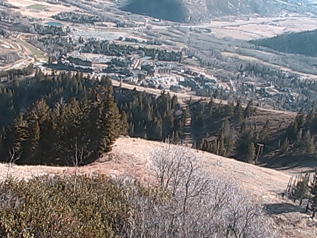
Lookout
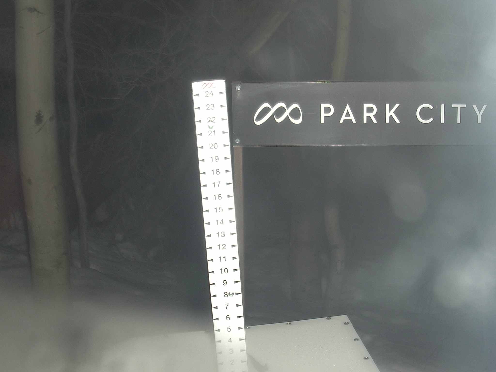
Snow Stake
SUNDAY
Apr 28

39° / 32°

4 - 12
mph
 0
0
MONDAY
Apr 29
41° / 22°

10 - 18
mph
0
TUESDAY
Apr 30
37° / 32°
7 - 15
mph
0
WEDNESDAY
May 1
37° / 18°

14 - 23
mph
0
THURSDAY
May 2

35° / 29°
5 - 12
mph
0
FRIDAY
May 3

46° / 38°
10 - 18
mph
0
advertisement

Partly cloudy becoming mostly clear in the evening continuing through overnight, with periods of rain expected in the morning through afternoon.
No snow.
Potential Precip:
0.02 to 0.09
Hi: 51°Low: 37°
9,292 feet to 10439 feet
Winds variable at 5 to 13 mph in the morning, becoming variable at 4 to 11 mph in the afternoon, and then variable at 3 to 11 mph overnight.
Partly cloudy becoming mostly clear in the evening continuing through overnight, with periods of snow expected in the morning through afternoon.
Periods of light snow during the day. Snowfall is forecast to be a trace amount during the day.
Potential Precip:
0.02 to 0.09
Hi: 35°Low: 29°
9,292 feet to 10439 feet
Winds W at 7 to 15 mph in the morning, becoming W at 6 to 14 mph in the afternoon, and then SW at 11 to 20 mph overnight.
Partly cloudy through the day and overnight, with periods of rain and snow expected overnight.
Light snow in the evening. Snowfall is forecast to be a trace amount in the evening.
Potential Precip:
0.02 to 0.08
Hi: 54°Low: 30°
5,977 feet to 10891 feet
Winds W at 12 to 21 mph in the morning, becoming variable at 5 to 13 mph in the afternoon, and then variable at 3 to 11 mph overnight.
Partly cloudy through the day and overnight, with periods of snow expected in the morning through evening.
Light snow through the day and into the evening. Snowfall is forecast to be a trace amount during the day, and a trace amount in the evening.
Potential Precip:
0.02 to 0.08
Hi: 37°Low: 19°
5,977 feet to 10891 feet
Winds W at 26 to 37 mph in the morning, becoming W at 11 to 20 mph with gusts to 29 in the afternoon, and then W at 8 to 16 mph with gusts to 33 overnight.
Mostly clear becoming mostly cloudy at times and then partly cloudy overnight.
No snow.
Potential Precip:
0 to 0.02
Hi: 49°Low: 39°
9,312 feet to 10425 feet
Winds SW at 7 to 15 mph in the morning, becoming variable at 4 to 11 mph in the afternoon, and then variable at 4 to 12 mph overnight.
Mostly clear becoming mostly cloudy at times and then partly cloudy overnight.
Periods of snow throughout the day and overnight.
Potential Precip:
0 to 0.02
Hi: 34°Low: 29°
9,312 feet to 10425 feet
Winds W at 10 to 19 mph in the morning, becoming W at 10 to 18 mph with gusts to 27 in the afternoon, and then W at 11 to 20 mph with gusts to 30 overnight.
Clear becoming partly cloudy at times and then mostly clear overnight.
Periods of snow throughout the day and overnight.
Potential Precip:
0 to 0.01
Hi: 50°Low: 27°
5,412 feet to 10102 feet
Winds variable at 9 to 17 mph through the day, becoming variable at 4 to 11 mph overnight.
Clear becoming partly cloudy at times and then mostly clear overnight.
Periods of snow throughout the day and overnight.
Potential Precip:
0 to 0.01
Hi: 33°Low: 15°
5,412 feet to 10102 feet
Winds W at 12 to 23 mph through the day, becoming NW at 8 to 16 mph with gusts to 26 overnight.
Partly cloudy becoming clear at times continuing through overnight, with windy conditions at times.
No snow.
No precipitation expected.
Hi: 49°Low: 34°
8,458 feet to 9799 feet
Winds variable at 5 to 12 mph throughout the day and into overnight.
Partly cloudy becoming clear at times continuing through overnight, with windy conditions at times.
No snow.
No precipitation expected.
Hi: 31°Low: 26°
8,458 feet to 9799 feet
Winds variable at 5 to 12 mph through the day, becoming SW at 6 to 14 mph overnight.
Clear becoming partly cloudy at times continuing through overnight, with windy conditions at times.
No snow.
No precipitation expected.
Hi: 60°Low: 42°
10,301 feet to 11780 feet
Winds W at 6 to 14 mph through the day, becoming variable at 5 to 13 mph overnight.
Clear becoming partly cloudy at times continuing through overnight, with windy conditions at times.
No snow.
No precipitation expected.
Hi: 42°Low: 34°
10,301 feet to 11780 feet
Winds SW at 10 to 19 mph through the day, becoming SW at 13 to 22 mph with gusts to 29 overnight.
 Sunrise & Sunset

Lunar Calendar


 Snow Maps and Weather Stations in the Area
 ![]() 12in, past 7 days. Snow surface is packed powder
12in, past 7 days. Snow surface is packed powder
Snow report provided by SnoCountry
 Mountain Base


