 Stevens Pass...
  Summit @ Sno... Summit @ Sno... Summit @ Sno...
 Summit @ Snoqualmie-West
  Stampede Pass, WA Updated May 15 @ 06:13


 WebCams

Top of Alpental

Alpental Base

Summit Central
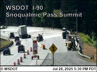
Summit Road Cam
WEDNESDAY
May 15
59° / 44°

4 - 12
mph
 0
0
THURSDAY
May 16

45° / 34°
5 - 13
mph
1
FRIDAY
May 17
45° / 35°
5 - 13
mph
0
SATURDAY
May 18
38° / 33°
6 - 14
mph
2
SUNDAY
May 19
41° / 35°
5 - 13
mph
0
MONDAY
May 20

40° / 37°
4 - 12
mph
0
TUESDAY
May 21
34° / 33°
5 - 12
mph
11
Mostly cloudy becoming partly cloudy in the late morning and then mostly cloudy overnight. Periods of rain are expected overnight.
No snow.
Potential Precip:
0 to 0.02
Hi: 59°Low: 44°
8,456 feet to 11893 feet
Winds NW at 8 to 16 mph in the morning, becoming variable at 4 to 12 mph in the afternoon through overnight.
Mostly cloudy becoming cloudy at times continuing through overnight. Periods of rain and snow are expected overnight.
Light snow through the day and into overnight. Snowfall is forecast to be a trace amount during the day, and 1 to 2 inches in the evening and overnight.
Potential Precip:
0.14 to 0.68
Hi: 45°Low: 34°
3,705 feet to 7906 feet
Winds variable at 5 to 13 mph through the day, becoming variable at 4 to 12 mph overnight.
Partly cloudy becoming mostly cloudy in the afternoon continuing through overnight. Periods of rain and snow are expected overnight.
Light snow in the evening through overnight. Snowfall is forecast to be a trace amount in the evening and overnight.
Potential Precip:
0.01 to 0.07
Hi: 45°Low: 35°
4,096 feet to 5811 feet
Winds NW at 7 to 15 mph in the morning, becoming variable at 5 to 13 mph in the afternoon, and then variable at 4 to 12 mph overnight.
Mostly cloudy becoming cloudy in the late morning and then mostly cloudy overnight. Periods of snow are expected at any time.
Periods of light to moderate snow throughout the day, light at times overnight. Snowfall is forecast to be 2 to 4 inches.
Potential Precip:
0.2 to 0.98
Hi: 38°Low: 33°
3,666 feet to 4499 feet
Winds variable at 5 to 13 mph in the morning, becoming NW at 6 to 14 mph in the afternoon, and then variable at 4 to 12 mph overnight.
Mostly cloudy becoming partly cloudy in the afternoon and then mostly cloudy overnight. Periods of rain and snow are expected overnight.
Periods of light snow throughout the day and overnight. Snowfall is forecast to be a trace amount.
Potential Precip:
0.04 to 0.19
Hi: 41°Low: 35°
4,357 feet to 5124 feet
Winds variable at 5 to 13 mph through the day, becoming variable at 4 to 12 mph overnight.
Cloudy through the day and overnight, with periods of rain and snow expected overnight.
Periods of light snow overnight. Snowfall is forecast to be a trace amount.
Potential Precip:
0.54 to 2.69
Hi: 40°Low: 37°
4,914 feet to 5921 feet
Winds variable at 4 to 12 mph through the day, becoming variable at 4 to 11 mph overnight.
Cloudy through the day and overnight, with periods of snow expected at any time.
Periods of heavy snow throughout the day, moderate at times overnight. Snowfall is forecast to be 9 to 13 inches.
Potential Precip:
0.82 to 4.08
Hi: 34°Low: 33°
3,721 feet to 4332 feet
Winds variable at 5 to 12 mph through the day, becoming variable at 4 to 11 mph overnight.
 Sunrise & Sunset

Lunar Calendar


 Snow Maps and Weather Stations in the Area
 ![]() 17 - 22in, past 72 hours. Snow surface is machine groomed and wet snow
17 - 22in, past 72 hours. Snow surface is machine groomed and wet snow
Snow report provided by SnoCountry
 Mid-Mountain


