 Stevens Pass... Summit @ Sno... Summit @ Sno... Summit @ Sno...
 Winter Park Resort
  Granby-Grand County Airport, CO Updated May 03 @ 04:13

 North
North WebCams

Winter Park Base Cam
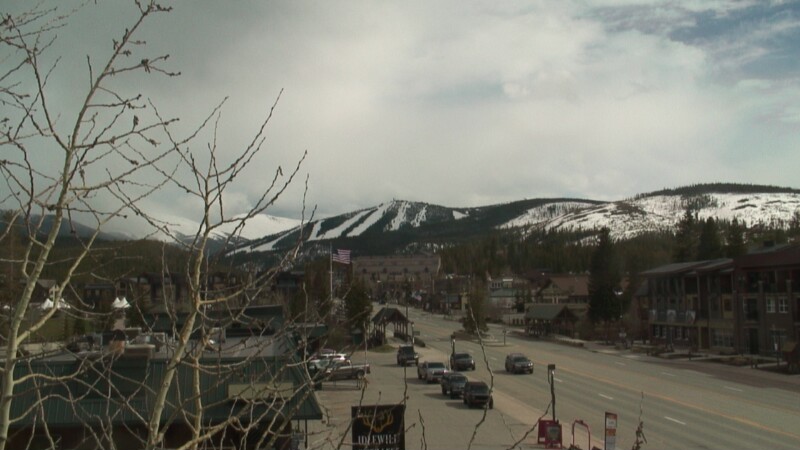
Winter Park Town cam
Snoasis

Sunspot
FRIDAY
May 3

38° / 24°

8 - 16
mph
 1
1
SATURDAY
May 4
43° / 34°
8 - 16
mph
1
SUNDAY
May 5
48° / 17°

10 - 18
mph
3
MONDAY
May 6
27° / 21°

41 - 52
mph
6
TUESDAY
May 7

25° / 15°
37 - 48
mph
5
WEDNESDAY
May 8
34° / 22°

23 - 34
mph
2
advertisement

Partly cloudy becoming clear at times continuing through overnight.
Light with periods of moderate during the day. Snowfall is forecast to be 1 to 2 during the day.
Potential Precip:
0.03 to 0.17
Hi: 48°Low: 28°
7,007 feet to 11765 feet
Winds W at 16 to 27 mph with gusts to 42 in the morning, becoming variable at 4 to 11 mph in the afternoon, and then variable at 3 to 11 mph overnight.
Partly cloudy becoming clear at times continuing through overnight, with periods of snow expected in the morning through afternoon.
Moderate with periods of heavy during the day. Snowfall is forecast to be 2 to 3 during the day.
Potential Precip:
0.03 to 0.17
Hi: 26°Low: 18°
7,007 feet to 11765 feet
Winds W at 29 to 40 mph in the morning, becoming W at 24 to 35 mph with gusts to 47 in the afternoon, and then SW at 25 to 36 mph with gusts to 46 overnight.
Partly cloudy becoming mostly clear at times and then partly cloudy overnight. Periods of rain are expected in the morning through afternoon.
No snow.
Potential Precip:
0.07 to 0.34
Hi: 54°Low: 38°
11,227 feet to 12696 feet
Winds variable at 10 to 18 mph in the morning, becoming variable at 5 to 12 mph in the afternoon, and then S at 8 to 16 mph with gusts to 23 overnight.
Partly cloudy becoming mostly clear at times and then partly cloudy overnight. Periods of snow are expected in the morning through afternoon.
Moderate with periods of heavy during the day. Snowfall is forecast to be 2 to 4 during the day.
Potential Precip:
0.07 to 0.34
Hi: 31°Low: 26°
11,227 feet to 12696 feet
Winds W at 10 to 19 mph in the morning, becoming SW at 17 to 28 mph in the afternoon, and then SW at 24 to 35 mph overnight.
Mostly cloudy through the day and overnight, with periods of snow developing in the evening through overnight.
Periods of light to moderate snow throughout the day, light at times overnight. Snowfall is forecast to be 2 to 3 inches.
Potential Precip:
0.08 to 0.38
Hi: 58°Low: 25°
6,784 feet to 13485 feet
Winds SW at 19 to 30 mph with gusts to 38 in the morning, becoming variable at 4 to 12 mph in the afternoon, and then W at 20 to 31 mph with gusts to 45 overnight.
Mostly cloudy through the day and overnight, with periods of snow developing in the evening through overnight.
Periods of moderate to heavy snow throughout the day, moderate at times overnight. Snowfall is forecast to be 3 to 6 inches.
Potential Precip:
0.08 to 0.38
Hi: 35°Low: 7°
6,784 feet to 13485 feet
Winds SW at 38 to 49 mph in the morning, becoming SW at 25 to 36 mph with gusts to 49 in the afternoon, and then W at 43 to 54 mph with gusts to 68 overnight.
Partly cloudy becoming mostly cloudy at times continuing through overnight, with periods of snow expected in the morning through overnight.
Periods of light snow throughout the day, heavy at times overnight. Snowfall is forecast to be 3 to 5 inches.
Potential Precip:
0.15 to 0.73
Hi: 38°Low: 28°
7,560 feet to 9815 feet
Winds W at 24 to 35 mph with gusts to 53 through the day, becoming W at 13 to 22 mph with gusts to 33 overnight.
Partly cloudy becoming mostly cloudy at times continuing through overnight, with periods of snow expected in the morning through overnight.
Periods of light to moderate snow throughout the day, heavy at times overnight. Snowfall is forecast to be 7 to 10 inches.
Potential Precip:
0.15 to 0.73
Hi: 15°Low: 12°
7,560 feet to 9815 feet
Winds W at 51 to 62 mph through the day, becoming W at 41 to 52 mph overnight.
Cloudy becoming clear at times continuing through overnight, with periods of snow expected in the morning through evening.
Periods of moderate to heavy snow throughout the day. Snowfall is forecast to be 3 to 5 inches.
Potential Precip:
0.11 to 0.53
Hi: 35°Low: 22°
5,751 feet to 9361 feet
Winds W at 21 to 32 mph with gusts to 44 through the day, becoming W at 18 to 29 mph with gusts to 40 overnight.
Cloudy becoming clear at times continuing through overnight, with periods of snow expected in the morning through evening.
Periods of heavy snow throughout the day. Snowfall is forecast to be 6 to 9 inches.
Potential Precip:
0.11 to 0.53
Hi: 14°Low: 5°
5,751 feet to 9361 feet
Winds W at 50 to 61 mph through the day, becoming W at 48 to 59 mph with gusts to 73 overnight.
Mostly cloudy becoming mostly clear at times continuing through overnight, with periods of rain and snow expected overnight.
Periods of light snow throughout the day, moderate at times overnight. Snowfall is forecast to be 1 to 2 inches.
Potential Precip:
0.05 to 0.25
Hi: 44°Low: 28°
7,321 feet to 11085 feet
Winds SW at 13 to 24 mph with gusts to 35 through the day, becoming variable at 4 to 12 mph overnight.
Mostly cloudy becoming mostly clear at times continuing through overnight, with periods of snow developing in the evening through overnight.
Periods of light snow throughout the day, moderate at times overnight. Snowfall is forecast to be 2 to 4 inches.
Potential Precip:
0.05 to 0.25
Hi: 23°Low: 17°
7,321 feet to 11085 feet
Winds W at 31 to 42 mph through the day, becoming variable at 14 to 25 mph with gusts to 34 overnight.
 Sunrise & Sunset

Lunar Calendar


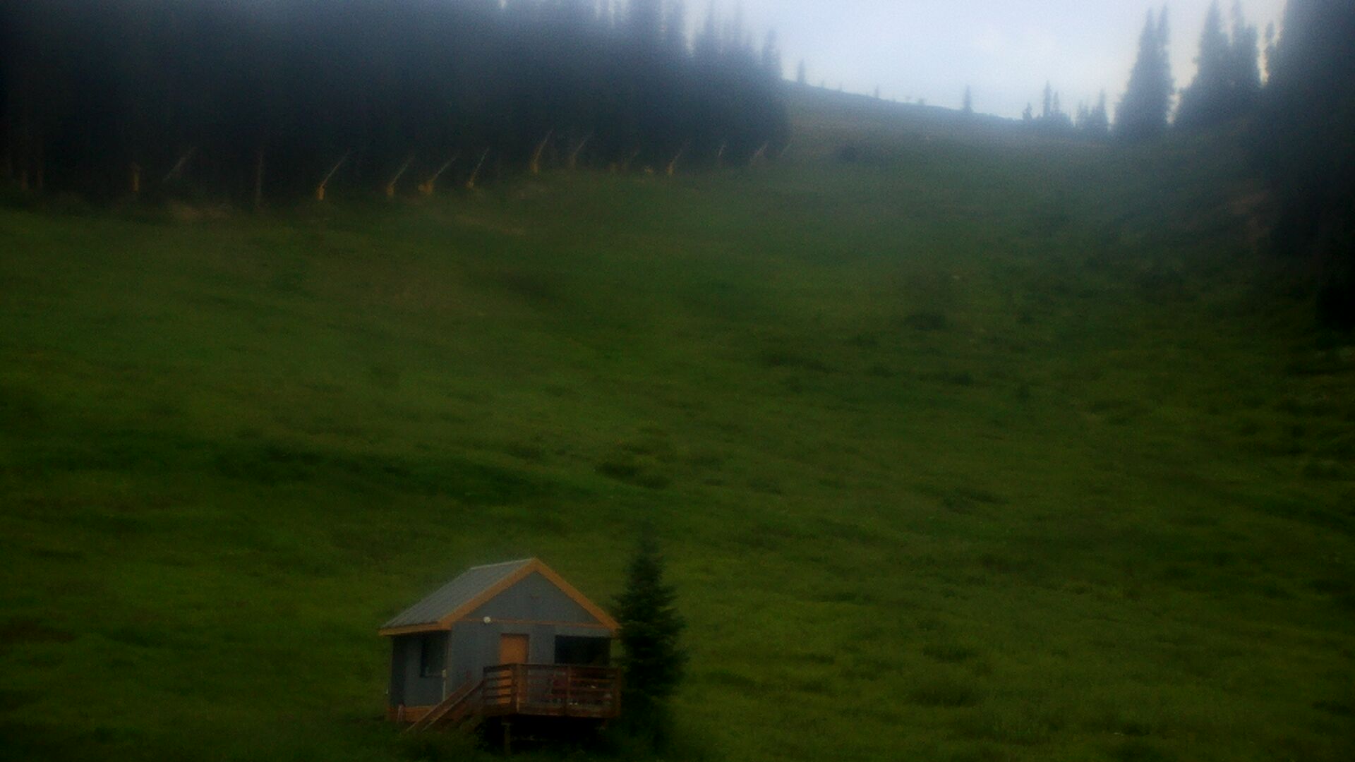
 Snow Maps and Weather Stations in the Area
 ![]() 22in, past 7 days. Snow surface is packed powder
22in, past 7 days. Snow surface is packed powder
Snow report provided by SnoCountry
Plan your future trip using our temperature, snowfall, snow depth, and precipitation tool
 Day |
 High Temperatures |
 Low Temperatures |
 Precipitation |
 Snowfall |
 Snow Depth |
||||||||||||||
|---|---|---|---|---|---|---|---|---|---|---|---|---|---|---|---|---|---|---|---|
| Avg | High | Year | Low | Year | Avg | High | Year | Low | Year | Avg | Max | Year | Avg | Max | Year | Avg | Max | Year | |
| 1 | 55 | 66 | 1946 | 40 | 1970 | 21 | 32 | 1947 | 5 | 1972 | 0.080 | 0.66 | 1980 | 0.58 | 6.0 | 1967 | 12.9 | 54 | 1984 |
| 2 | 54 | 67 | 1943 | 44 | 1970 | 21 | 40 | 1947 | 6 | 1970 | 0.069 | 0.46 | 1999 | 0.64 | 5.0 | 1988 | 12.3 | 54 | 1984 |
| 3 | 54 | 68 | 1971 | 36 | 1944 | 20 | 40 | 1947 | 10 | 1972 | 0.073 | 0.65 | 1974 | 0.43 | 6.0 | 1944 | 11.1 | 53 | 1984 |
| 4 | 56 | 70 | 1971 | 37 | 1944 | 20 | 40 | 1947 | -2 | 1944 | 0.058 | 0.46 | 1989 | 0.44 | 6.0 | 1978 | 10.0 | 58 | 1984 |
| 5 | 57 | 68 | 1972 | 42 | 2003 | 26 | 40 | 1947 | 16 | 1944 | 0.089 | 1.49 | 1960 | 0.74 | 14.0 | 1960 | 9.4 | 56 | 1984 |
| 6 | 55 | 68 | 1970 | 42 | 1948 | 25 | 41 | 1947 | 11 | 1948 | 0.092 | 1.27 | 1973 | 0.30 | 8.0 | 1973 | 7.5 | 55 | 1984 |
| 7 | 54 | 65 | 2002 | 37 | 1943 | 26 | 42 | 1947 | 20 | 1972 | 0.138 | 2.78 | 1969 | 0.94 | 14.0 | 1973 | 7.3 | 57 | 1984 |
| 8 | 55 | 67 | 2002 | 32 | 1945 | 25 | 39 | 1947 | 14 | 1970 | 0.101 | 0.67 | 1979 | 0.64 | 7.0 | 1979 | 7.5 | 53 | 1984 |
| 9 | 58 | 67 | 2002 | 46 | 2003 | 24 | 40 | 1947 | 13 | 1943 | 0.146 | 1.40 | 1957 | 0.75 | 8.0 | 1979 | 7.1 | 50 | 1984 |
| 10 | 56 | 67 | 1947 | 36 | 1948 | 23 | 40 | 1947 | 13 | 1948 | 0.119 | 0.94 | 2016 | 0.61 | 9.0 | 2003 | 6.4 | 48 | 1984 |
| 11 | 55 | 62 | 2002 | 40 | 1945 | 27 | 34 | 1948 | 20 | 2003 | 0.083 | 0.93 | 1946 | 0.39 | 4.0 | 2011 | 5.5 | 44 | 1984 |
| 12 | 55 | 66 | 1970 | 48 | 1945 | 22 | 31 | 2002 | 14 | 1946 | 0.071 | 0.58 | 1982 | 0.40 | 5.0 | 1982 | 4.8 | 41 | 1984 |
| 13 | 53 | 66 | 1970 | 42 | 1971 | 24 | 30 | 1947 | 20 | 1946 | 0.075 | 1.44 | 1982 | 0.64 | 21.0 | 1982 | 4.4 | 39 | 1984 |
| 14 | 60 | 68 | 1971 | 50 | 1972 | 25 | 37 | 1947 | 20 | 1970 | 0.081 | 0.73 | 1982 | 0.30 | 6.0 | 2010 | 3.4 | 36 | 1984 |
| 15 | 59 | 66 | 1948 | 48 | 1970 | 26 | 39 | 1947 | 11 | 1970 | 0.078 | 0.75 | 1977 | 0.29 | 5.0 | 1983 | 2.8 | 34 | 1983 |
| 16 | 60 | 69 | 1972 | 48 | 1943 | 26 | 40 | 1947 | 16 | 1970 | 0.132 | 2.02 | 1991 | 0.62 | 17.0 | 1991 | 2.9 | 33 | 1983 |
| 17 | 62 | 72 | 1972 | 48 | 1946 | 25 | 40 | 1947 | 15 | 1943 | 0.133 | 1.41 | 1983 | 0.50 | 15.0 | 1983 | 2.7 | 49 | 1983 |
| 18 | 60 | 74 | 1948 | 36 | 1944 | 29 | 40 | 1947 | 18 | 1971 | 0.110 | 1.00 | 1978 | 0.63 | 9.0 | 1978 | 2.8 | 49 | 1983 |
| 19 | 60 | 74 | 1972 | 48 | 1971 | 30 | 47 | 1948 | 19 | 1971 | 0.064 | 0.52 | 1960 | 0.09 | 3.0 | 2011 | 1.9 | 42 | 1983 |
| 20 | 58 | 75 | 1970 | 36 | 1946 | 24 | 34 | 1948 | 11 | 1946 | 0.100 | 0.78 | 1967 | 0.34 | 6.0 | 1988 | 1.6 | 40 | 1983 |
| 21 | 62 | 78 | 1970 | 50 | 1946 | 27 | 42 | 1947 | 20 | 1971 | 0.058 | 0.50 | 2001 | 0.13 | 4.0 | 1981 | 1.4 | 37 | 1983 |
| 22 | 63 | 73 | 1948 | 46 | 1945 | 27 | 42 | 1947 | 15 | 1945 | 0.060 | 0.40 | 1987 | 0.08 | 3.0 | 1962 | 1.1 | 36 | 1983 |
| 23 | 61 | 72 | 1970 | 50 | 2002 | 27 | 40 | 1947 | 20 | 1972 | 0.069 | 0.70 | 1954 | 0.03 | 1.0 | 2008 | 0.9 | 33 | 1983 |
| 24 | 60 | 72 | 1970 | 50 | 1971 | 28 | 40 | 1947 | 20 | 1971 | 0.081 | 0.83 | 2012 | 0.23 | 6.0 | 2002 | 1.1 | 30 | 1983 |
| 25 | 61 | 72 | 1970 | 46 | 2002 | 28 | 45 | 1947 | 20 | 1971 | 0.077 | 0.84 | 1995 | 0.09 | 6.0 | 1995 | 0.9 | 27 | 1983 |
| 26 | 64 | 75 | 1972 | 55 | 1948 | 28 | 46 | 1947 | 21 | 1971 | 0.088 | 0.71 | 1950 | 0.19 | 6.0 | 1996 | 0.9 | 24 | 1983 |
| 27 | 64 | 75 | 1972 | 52 | 1944 | 30 | 44 | 1947 | 23 | 1970 | 0.081 | 1.70 | 1996 | 0.08 | 4.0 | 1996 | 0.7 | 18 | 1983 |
| 28 | 68 | 78 | 1971 | 51 | 1944 | 32 | 37 | 2003 | 24 | 1972 | 0.065 | 0.59 | 1992 | 0.07 | 2.0 | 1992 | 0.6 | 14 | 1983 |
| 29 | 65 | 78 | 2003 | 44 | 1947 | 32 | 38 | 1947 | 20 | 1972 | 0.063 | 0.60 | 1946 | 0.06 | 2.0 | 2013 | 0.5 | 11 | 1957 |
| 30 | 63 | 78 | 2003 | 40 | 1946 | 31 | 42 | 1947 | 21 | 1972 | 0.054 | 1.03 | 1943 | 0.13 | 3.0 | 1979 | 0.3 | 9 | 1957 |
| 31 | 65 | 78 | 2003 | 44 | 1946 | 31 | 46 | 1947 | 20 | 1971 | 0.097 | 0.79 | 1979 | 0.11 | 3.0 | 1979 | 0.2 | 6 | 1979 |
Day |
High Temperatures |
Low Temperatures |
Precipitation |
Snowfall |
Snow Depth |
||||||||||||||
|---|---|---|---|---|---|---|---|---|---|---|---|---|---|---|---|---|---|---|---|
| Avg | High | Year | Low | Year | Avg | High | Year | Low | Year | Avg | Max | Year | Avg | Max | Year | Avg | Max | Year | |
| 1 | 40 | 54 | 1965 | 16 | 1967 | 16 | 30 | 1977 | -3 | 1972 | 0.182 | 1.47 | 1980 | 1.90 | 12.0 | 1980 | 64.2 | 101 | 1984 |
| 2 | 41 | 58 | 1981 | 18 | 1967 | 19 | 33 | 1981 | 2 | 1967 | 0.110 | 0.76 | 1979 | 1.33 | 10.0 | 1979 | 63.3 | 101 | 1984 |
| 3 | 42 | 53 | 1981 | 25 | 1967 | 19 | 29 | 1981 | 3 | 1967 | 0.115 | 0.52 | 1981 | 1.40 | 7.0 | 1984 | 62.8 | 105 | 1984 |
| 4 | 44 | 54 | 1966 | 31 | 1967 | 20 | 30 | 1982 | 5 | 1967 | 0.135 | 0.80 | 1984 | 1.33 | 8.0 | 1984 | 61.7 | 109 | 1984 |
| 5 | 45 | 57 | 1966 | 28 | 1978 | 21 | 30 | 1966 | 8 | 1978 | 0.075 | 0.55 | 1969 | 0.90 | 5.5 | 1969 | 61.0 | 108 | 1984 |
| 6 | 42 | 58 | 1966 | 25 | 1978 | 21 | 33 | 1979 | 6 | 1982 | 0.195 | 0.88 | 1978 | 2.20 | 11.0 | 1973 | 61.5 | 107 | 1984 |
| 7 | 38 | 58 | 1966 | 20 | 1978 | 19 | 32 | 1966 | 3 | 1978 | 0.340 | 3.06 | 1969 | 3.31 | 30.0 | 1969 | 62.6 | 111 | 1984 |
| 8 | 38 | 58 | 1966 | 24 | 1978 | 19 | 31 | 1974 | 6 | 1968 | 0.192 | 1.09 | 1969 | 1.91 | 10.0 | 1979 | 62.1 | 108 | 1984 |
| 9 | 41 | 55 | 1977 | 25 | 1965 | 20 | 32 | 1974 | 5 | 1978 | 0.137 | 0.74 | 1979 | 1.71 | 9.0 | 1981 | 62.2 | 105 | 1984 |
| 10 | 43 | 54 | 1977 | 31 | 1981 | 21 | 32 | 1974 | 3 | 1979 | 0.116 | 0.55 | 1966 | 0.88 | 4.0 | 1979 | 60.5 | 101 | 1984 |
| 11 | 44 | 55 | 1984 | 28 | 1979 | 22 | 30 | 1984 | 7 | 1979 | 0.058 | 0.34 | 1968 | 0.67 | 4.0 | 1964 | 59.1 | 96 | 1984 |
| 12 | 43 | 52 | 1984 | 34 | 1964 | 19 | 31 | 1984 | 4 | 1979 | 0.179 | 0.78 | 1982 | 1.81 | 9.0 | 1982 | 59.0 | 93 | 1984 |
| 13 | 42 | 55 | 1984 | 29 | 1980 | 21 | 32 | 1984 | 12 | 1981 | 0.210 | 2.10 | 1982 | 2.07 | 21.0 | 1982 | 59.4 | 91 | 1984 |
| 14 | 43 | 60 | 1984 | 25 | 1983 | 21 | 35 | 1984 | 10 | 1983 | 0.116 | 1.20 | 1982 | 1.36 | 12.0 | 1982 | 58.3 | 89 | 1982 |
| 15 | 44 | 58 | 1978 | 28 | 1967 | 23 | 36 | 1978 | 9 | 1970 | 0.166 | 1.06 | 1977 | 1.64 | 10.0 | 1977 | 57.8 | 89 | 1982 |
| 16 | 46 | 58 | 1978 | 30 | 1983 | 24 | 35 | 1974 | 15 | 1968 | 0.070 | 0.66 | 1969 | 0.59 | 7.0 | 1969 | 56.2 | 86 | 1982 |
| 17 | 47 | 58 | 1978 | 29 | 1981 | 24 | 34 | 1964 | 13 | 1983 | 0.217 | 1.98 | 1983 | 1.98 | 20.0 | 1983 | 54.8 | 82 | 1982 |
| 18 | 46 | 57 | 1964 | 23 | 1983 | 24 | 36 | 1970 | 12 | 1971 | 0.154 | 0.80 | 1978 | 1.64 | 8.0 | 1978 | 54.7 | 79 | 1984 |
| 19 | 46 | 56 | 1976 | 31 | 1971 | 25 | 36 | 1970 | 12 | 1968 | 0.067 | 0.42 | 1984 | 0.59 | 5.0 | 1971 | 52.9 | 80 | 1984 |
| 20 | 48 | 56 | 1970 | 33 | 1983 | 26 | 34 | 1970 | 17 | 1974 | 0.083 | 0.38 | 1973 | 0.67 | 4.0 | 1967 | 51.2 | 77 | 1984 |
| 21 | 47 | 61 | 1964 | 32 | 1974 | 27 | 39 | 1984 | 16 | 1983 | 0.059 | 0.30 | 1981 | 0.40 | 3.5 | 1981 | 49.6 | 74 | 1984 |
| 22 | 49 | 61 | 1964 | 37 | 1974 | 27 | 36 | 1964 | 16 | 1974 | 0.057 | 0.30 | 1978 | 0.43 | 2.0 | 1983 | 48.0 | 72 | 1984 |
| 23 | 49 | 58 | 1980 | 37 | 1975 | 26 | 35 | 1964 | 13 | 1966 | 0.085 | 0.78 | 1975 | 0.71 | 7.0 | 1975 | 46.8 | 70 | 1984 |
| 24 | 49 | 60 | 1984 | 34 | 1975 | 26 | 42 | 1984 | 17 | 1971 | 0.048 | 0.30 | 1971 | 0.23 | 1.5 | 1971 | 45.1 | 68 | 1984 |
| 25 | 50 | 60 | 1967 | 38 | 1965 | 26 | 39 | 1964 | 11 | 1980 | 0.080 | 0.58 | 1984 | 0.62 | 5.0 | 1984 | 43.9 | 69 | 1984 |
| 26 | 48 | 60 | 1964 | 37 | 1965 | 26 | 35 | 1969 | 14 | 1980 | 0.163 | 0.82 | 1982 | 1.40 | 8.0 | 1982 | 43.3 | 72 | 1982 |
| 27 | 49 | 61 | 1969 | 30 | 1973 | 27 | 37 | 1969 | 14 | 1973 | 0.072 | 0.41 | 1965 | 0.67 | 5.0 | 1965 | 41.7 | 67 | 1982 |
| 28 | 49 | 62 | 1969 | 32 | 1973 | 27 | 36 | 1974 | 11 | 1973 | 0.081 | 0.50 | 1978 | 0.37 | 4.0 | 1978 | 40.1 | 64 | 1982 |
| 29 | 49 | 58 | 1969 | 34 | 1975 | 27 | 34 | 1969 | 18 | 1965 | 0.091 | 0.44 | 1981 | 0.71 | 5.0 | 1975 | 38.6 | 61 | 1982 |
| 30 | 49 | 59 | 1969 | 32 | 1975 | 27 | 36 | 1969 | 14 | 1975 | 0.065 | 0.40 | 1979 | 0.74 | 5.5 | 1979 | 37.4 | 58 | 1982 |
| 31 | 48 | 61 | 1966 | 35 | 1979 | 25 | 36 | 1984 | 13 | 1979 | 0.130 | 1.01 | 1979 | 1.07 | 10.0 | 1979 | 36.6 | 61 | 1982 |
 Mountain Base


